S5713 : Waterford Bypass Toll Booths at Gracedieu
taken 6 years ago, 3 km from Waterford, Co Waterford, Ireland
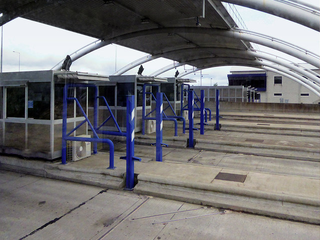
Waterford Bypass Toll Booths at Gracedieu
The N25 Waterford Bypass including the 465 metre-long cable-stayed bridge over the River Suir opened to traffic in October 2009 to alleviate congestion in and around the port and improve the travelling conditions in the region by making the journey shorter and safer. About 14,000 vehicles use the Waterford bypass each day reducing the traffic volumes using the Rice Bridge by about 30%. The Waterford bypass has helped by taking about 10,000 to 12,000 vehicles a day away from the city quays.
The road is operated as a toll road with five toll lanes in each direction and a toll plaza located on the South side of the River Suir Bridge. The toll plaza includes an administration building, toll plaza canopy and tunnel and associated toll collection system, located in Gracedieu.
The road is operated as a toll road with five toll lanes in each direction and a toll plaza located on the South side of the River Suir Bridge. The toll plaza includes an administration building, toll plaza canopy and tunnel and associated toll collection system, located in Gracedieu.
Irish National Primary Road N25
The N25 road is a national primary road in Ireland, forming the route from Cork to Rosslare Europort via Waterford City. The road is part of the E30 European route and a short section is also part of the E01 European route. It forms part of the proposed Atlantic Corridor route (Wikipedia).
![Creative Commons Licence [Some Rights Reserved]](https://s1.geograph.org.uk/img/somerights20.gif)
|
· Find out How to reuse this image ·
Share:
|
|||||
| Start a discussion on S5713 | Suggest an update to this image | Contact the contributor | |||
Loading map... (JavaScript required)
- Grid Square
- S5713, 8 images (more nearby
 )
)
- Photographer
- David Dixon (find more nearby)
- Date Taken
- Sunday, 17 June, 2018 (more nearby)
- Submitted
- Wednesday, 20 March, 2019
- Geographical Context
- Camera (from Tags)
- Road (from Tags)
- Subject Location
-
Irish:
 S 574 138 [100m precision]
WGS84: 52:16.4286N 7:9.5193W - Camera Location
-
Irish: S 574 138
- View Direction
- Northwest (about 315 degrees)
Other Tags
This page has been viewed about 44 times.
View this location:
KML (Google Earth) ·
Google Maps ·
Bing Maps ·
Geograph Coverage Map ·
More Links for this image
·
Bing Maps ·
Geograph Coverage Map ·
More Links for this image