2019
ST7564 : Ferry Lane, Bath
taken 5 years ago, near to Bath, Bath And North East Somerset, England
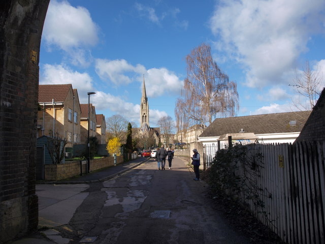
Ferry Lane, Bath
Ferry Lane is seen here looking from under the railway bridge (see ST7564 : Railway bridge over Ferry Lane, Bath) towards the river. The Bath half marathon meant many more passers-by than normal for a Sunday morning.
 Map © Crown Copyright")
TIP: Click the map for more Large scale mapping
- Grid Square
- ST7564, 2478 images (more nearby 🔍)
- Photographer
- Alec MacKinnon (more nearby)
- Date Taken
- Sunday, 17 March, 2019 (more nearby)
- Submitted
- Friday, 22 March, 2019
- Subject Location
-
OSGB36:
 ST 7550 6459 [10m precision]
WGS84: 51:22.7896N 2:21.2048W - Camera Location
-
OSGB36: ST 7555 6460
- View Direction
- WEST (about 270 degrees)