2019
NS3779 : Carman Hill-fort: possible hut circle
taken 5 years ago, near to Alexandria, West Dunbartonshire, Scotland
This is 1 of 2 images, with title Carman Hill-fort: possible hut circle in this square
Carman Hill-fort: possible hut circle
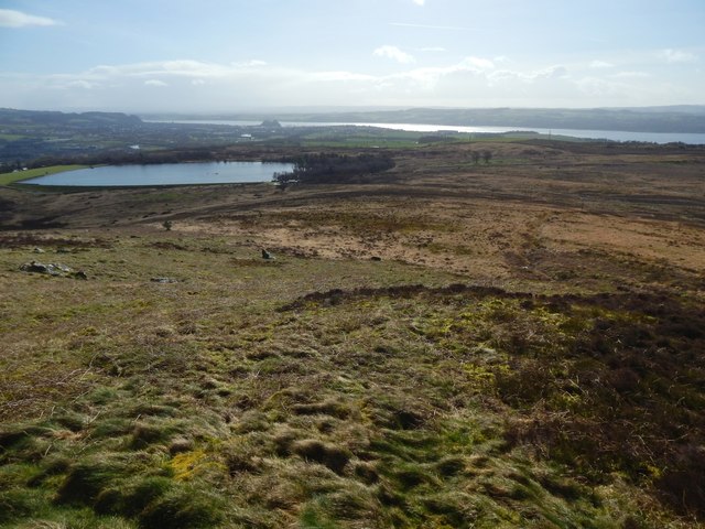
Right of centre in the foreground is a circular depression; its far edge is easy to see, and its near edge, though less apparent, is also visible. This appears to be the hut circle that large-scale mapping shows just inside the southern extremity of the fort's outer enclosure.
The view is from the boulders shown in NS3779 : Boulders on Carman Hill. See NS3779 : Carman Hill-fort: possible hut circle for a side view; in that picture, the dark vegetation that marks the hut circle's far side is on the left.
In the present image, Carman Reservoir is in the left background, with Dumbuck Quarry behind its left half, Dumbarton Rock behind its right half, and the River Clyde beyond.
Carman Hill-fort
This large hill-fort see Link
(at Canmore) was identified in 1954 from aerial photographs, and is thought to date from the Early Historic period (Dark Ages). See Link for a Geograph article on the fort. See Link
Carman Reservoir :: NS3778
Known locally as the Dam. See Link (in a Geograph article) for further information. The reservoir, which was officially opened in 1886, is now disused; there is a trout fishery based alongside it. Carman Reservoir was created by damming and enlarging an existing Carman Loch, which was itself artificial: the loch had been created in connection with the nearby Millburn Works; it was also occasionally used for curling.
 Map © Crown Copyright")
TIP: Click the map for more Large scale mapping
- Grid Square
- NS3779, 116 images (more nearby 🔍)
- Photographer
- Lairich Rig (more nearby)
- Date Taken
- Monday, 11 March, 2019 (more nearby)
- Submitted
- Sunday, 24 March, 2019
- Subject Location
-
OSGB36:
 NS 3719 7938 [10m precision]
WGS84: 55:58.7822N 4:36.6571W - Camera Location
-
OSGB36: NS 3719 7939
- View Direction
- South-southeast (about 157 degrees)