2018
SK4860 : Exit to Stoneyford Road
taken 6 years ago, near to Stanton Hill, Nottinghamshire, England
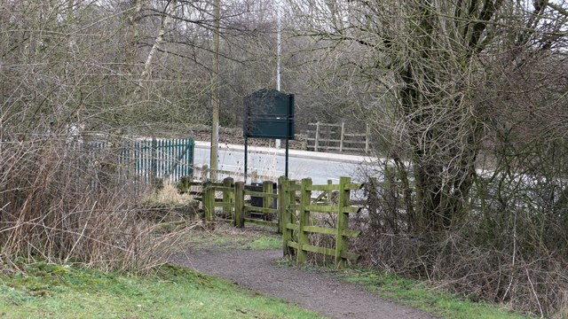
Exit to Stoneyford Road
The photograph shows the exit from Brierley Forest Park onto SK4860 : Stoneyford Road (B6028). The road runs between Stanton Hill, to the left and Sutton-in-Ashfield, to the right.
It was near this point that the Midland Railway's Skegby Colliery Branch terminated, as can be seen from this OS map dated 1892-14 from the National Library of Scotland Link
 Map © Crown Copyright")
TIP: Click the map for more Large scale mapping
- Grid Square
- SK4860, 49 images (more nearby 🔍)
- Photographer
- Alan Walker (more nearby)
- Date Taken
- Sunday, 11 March, 2018 (more nearby)
- Submitted
- Wednesday, 3 April, 2019
- Subject Location
-
OSGB36:
 SK 4875 6044 [10m precision]
WGS84: 53:8.3334N 1:16.3629W - Camera Location
-
OSGB36: SK 4874 6040
- View Direction
- North-northeast (about 22 degrees)