2018
SK4860 : Path near the eastern edge of Brierley Forest Park
taken 6 years ago, near to Stanton Hill, Nottinghamshire, England
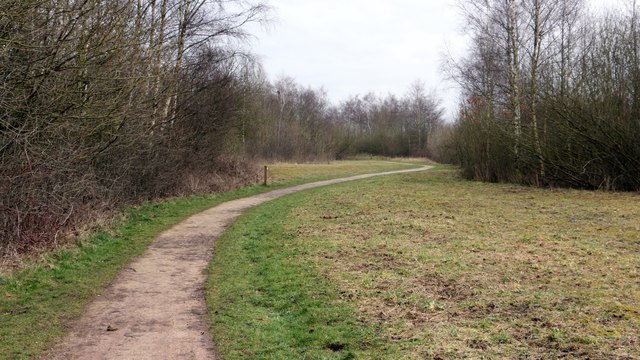
Path near the eastern edge of Brierley Forest Park
Ahead this path follows the approximate route of the Midland Railway's Skegby Colliery Branch. Not far beyond the bend in the distance is an SK4860 : Exit to Stoneyford Road.
A short distance behind the viewpoint are paths leading to Stanton Hill, the Brierley Forest Visitor Centre, Carsic Bank, a SK4860 : Mountain bike track and Rooley Tops.
To the left of the path is Brierley Park Industrial Estate, part of which is built on the site of the former Sutton Colliery as can be seen from this OS map dated 1892-14 from the National Library of Scotland Link
 Map © Crown Copyright")
TIP: Click the map for more Large scale mapping
- Grid Square
- SK4860, 49 images (more nearby 🔍)
- Photographer
- Alan Walker (more nearby)
- Date Taken
- Sunday, 11 March, 2018 (more nearby)
- Submitted
- Wednesday, 3 April, 2019
- Subject Location
-
OSGB36:
 SK 4865 6033 [10m precision]
WGS84: 53:8.2746N 1:16.4535W - Camera Location
-
OSGB36: SK 4856 6029
- View Direction
- East-northeast (about 67 degrees)