2019
SO9868 : Inflow into Tardebigge Reservoir
taken 5 years ago, near to Tardebigge, Worcestershire, England
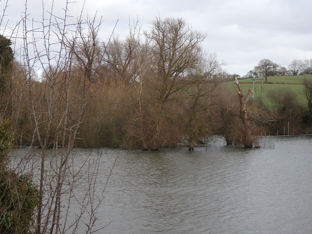
Inflow into Tardebigge Reservoir
The reservoir is fed by a small stream and a number of springs, which make the northern end distinctly marshy. The water level is at the maximum here, with water topping over the overflow Link into the Worcester & Birmingham Canal. The reservoir was built to supply the operation of the Tardebigge flight of locks on the canal. The operational supply is through a sluice gate Link near the top of the flight and was supplemented by water pumped Link from the lake to feed the canal above the flight.
 Map © Crown Copyright")
TIP: Click the map for more Large scale mapping
- Grid Square
- SO9868, 189 images (more nearby 🔍)
- Photographer
- Rudi Winter (more nearby)
- Date Taken
- Saturday, 9 February, 2019 (more nearby)
- Submitted
- Thursday, 11 April, 2019
- Subject Location
-
OSGB36:
 SO 9861 6867 [10m precision]
WGS84: 52:18.9680N 2:1.3088W - Camera Location
-
OSGB36: SO 9848 6865
- View Direction
- East-northeast (about 67 degrees)