J0633 : The Pointed Canal Bridge over the Newry Canal at Jerrettspass
taken 5 years ago, near to Jerrettspass, Co Armagh, Northern Ireland
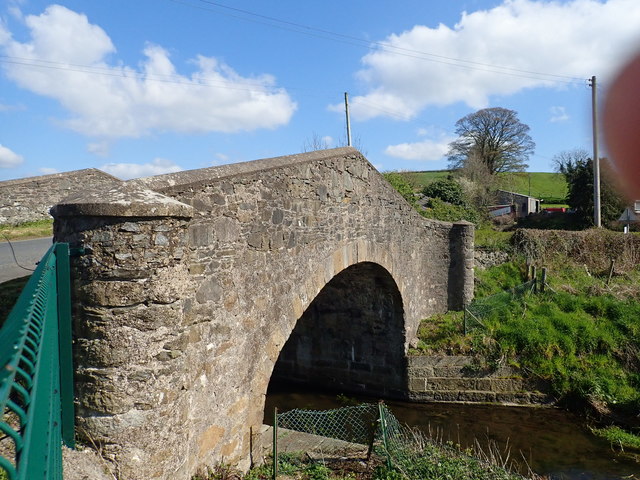
The Pointed Canal Bridge over the Newry Canal at Jerrettspass
This was designed by John Brownrigg in 1808. It carries the Carrickovaddy Road eastwards across the Canal and leads to the boundary between South Armagh and South Down.
![Creative Commons Licence [Some Rights Reserved]](https://s1.geograph.org.uk/img/somerights20.gif)
|
· Find out How to reuse this image ·
Share:
|
|||||
| Start a discussion on J0633 | Suggest an update to this image | Contact the contributor | |||
Loading map... (JavaScript required)
- Grid Square
- J0633, 71 images (more nearby
 )
)
- Photographer
- Eric Jones (find more nearby)
- Date Taken
- Wednesday, 10 April, 2019 (more nearby)
- Submitted
- Saturday, 13 April, 2019
- Geographical Context
- Subject Location
-
Irish:
 J 063 332 [100m precision]
WGS84: 54:14.2048N 6:22.1438W - Camera Location
-
Irish: J 063 332
- View Direction
- East-northeast (about 67 degrees)
This page has been viewed about 40 times.
View this location:
KML (Google Earth) ·
Google Maps ·
Bing Maps ·
Geograph Coverage Map ·
More Links for this image
·
Bing Maps ·
Geograph Coverage Map ·
More Links for this image