2019
NZ9504 : Boggle Hole
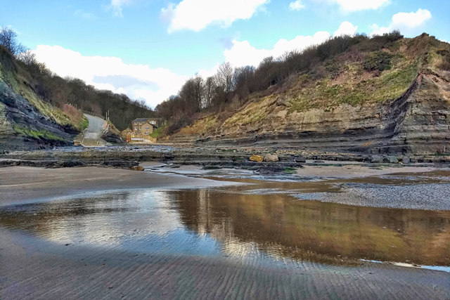
taken 5 years ago, near to Robin Hood's Bay, North Yorkshire, England
This is 1 of 15 images, with title Boggle Hole in this square
Boggle Hole
A name best known for the Youth Hostel that occupies the old corn mill buildings at the foot of a steep rocky ravine down which Mill Beck flows into the sea. Boggle Hole is one of the last six remaining Youth Hostels in the North York Moors, the others being Whitby, Scarborough, Osmotherley, Helmsley and Lockton. The old mill was Bay Mill and Boggle Hole is actually a small cave in the cliff a short distance to the left. It was supposedly the home of a boggle, a small, hairy, malevolent creature whose kin are found in folklore throughout Northern England and Scotland, and go by various names: hobs, pixies, goblins, boggarts, brownies. It was thought that boggles had magical healing powers and in this case, it could cure whooping cough. The locals would bring their sick children to its cave in the hope of them being cured.
From my photo-diary for 14 April 2019 see Link
From my photo-diary for 14 April 2019 see Link
 Map © Crown Copyright")
TIP: Click the map for more Large scale mapping
- Grid Square
- NZ9504, 530 images (more nearby 🔍)
- Photographer
- Mick Garratt (more nearby)
- Date Taken
- Sunday, 14 April, 2019 (more nearby)
- Submitted
- Sunday, 14 April, 2019
- Subject Location
-
OSGB36:
 NZ 9538 0403 [10m precision]
WGS84: 54:25.3662N 0:31.8889W - Camera Location
-
OSGB36: NZ 95568 04057
- View Direction
- WEST (about 270 degrees)