2019
NO6991 : Upland landscape
taken 5 years ago, near to Blackness, Aberdeenshire, Scotland
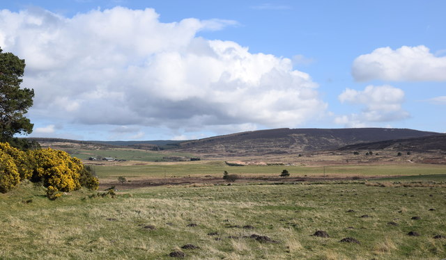
Upland landscape
The Burn of Curran runs through boggy ground and much farther back are the slopes of Shillofad hill (elev. 365 m).
 Map © Crown Copyright")
TIP: Click the map for more Large scale mapping
- Grid Square
- NO6991, 33 images (more nearby 🔍)
- Photographer
- Bill Harrison (more nearby)
- Date Taken
- Sunday, 31 March, 2019 (more nearby)
- Submitted
- Wednesday, 17 April, 2019
- Subject Location
-
OSGB36:
 NO 6954 9130 [10m precision]
WGS84: 57:0.7097N 2:30.1915W - Camera Location
-
OSGB36: NO 6930 9146
- View Direction
- Southeast (about 135 degrees)