2019
SE4995 : Ruined lime kiln above Cringle Ing
taken 5 years ago, 5 km ESE of Osmotherley, North Yorkshire, England
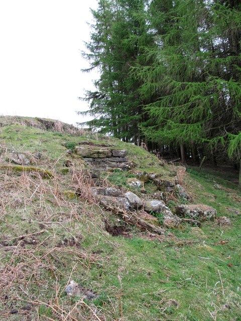
Ruined lime kiln above Cringle Ing
There's not much left of this lime kiln which is situated only a few metres away from the road and which I have passed many times over the years without ever spotting it. Found, thanks to looking at Victorian 6" maps. Like several others in the vicinity, it is well away from supplies of limestone, which would have to be transported here either by cart or in panniers from the limestone uplands across the other side of the valley where there were quarries either side of the Hambleton Drove Road. Local fuel could be coal, peat or wood.
 Map © Crown Copyright")
TIP: Click the map for more Large scale mapping
- Grid Square
- SE4995, 43 images (more nearby 🔍)
- Photographer
- Gordon Hatton (more nearby)
- Date Taken
- Sunday, 28 April, 2019 (more nearby)
- Submitted
- Tuesday, 30 April, 2019
- Subject Location
-
OSGB36:
 SE 4970 9519 [10m precision]
WGS84: 54:20.9902N 1:14.2134W - Camera Location
-
OSGB36: SE 4969 9520
- View Direction
- Southeast (about 135 degrees)