2019
SK9572 : A drainage channel near Saxilby Road, Lincoln
taken 5 years ago, near to Lincoln, Lincolnshire, England
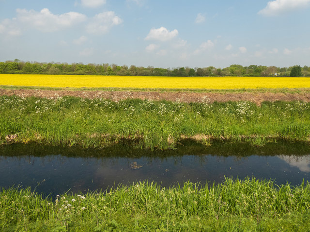
A drainage channel near Saxilby Road, Lincoln
This channel is part of a network of drains which eventually connect to the Fossdyke navigation. There are no marked footpaths (either by signpost or on maps) along this channel but it is completely accessible and gives access to the popular cycle track along the Fossdyke. Beyond the trees in the background is the A46.
 Map © Crown Copyright")
TIP: Click the map for more Large scale mapping
- Grid Square
- SK9572, 43 images (more nearby 🔍)
- Photographer
- Oliver Mills (more nearby)
- Date Taken
- Wednesday, 1 May, 2019 (more nearby)
- Submitted
- Friday, 3 May, 2019
- Subject Location
-
OSGB36:
 SK 953 725 [100m precision]
WGS84: 53:14.4586N 0:34.3798W - Camera Location
-
OSGB36: SK 953 724
- View Direction
- North-northwest (about 337 degrees)