SO6775 : Memorial - Cleobury Mortimer Market Hall - April 2019 (1)
taken 5 years ago, near to Cleobury Mortimer, Shropshire, England
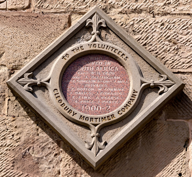
War memorials were mainly constructed after WWI to commemorate the troops who gave their lives in the war. Many were then updated after WWII. Some war memorials date back to the Boer War. Almost every town and village in Britain has a War Memorial. They take many forms, the commonest being an obelisk, a cross or statue of a soldier. Some commemorate the inhabitants of a place, some are for schools and others are for companies or Military groupings.
Many memorials are grade II listed, 61 are II* listed, Link*_listed_war_memorials_in_England
& 12 are Grade I listed. Link
A search for memorials can be carried out at Link
Cleobury Mortimer (pronounced Clibbree) is a small town in Shropshire, granted its charter in 1253. The town lies on the A4117 just to the west of the River Rea. It is home to the Hobson Brewery. The town possesses a number of listed buildings. Link
The town has a range of services including several pubs, secondary & primary school, fire station, police station & a range of shops. The church has a crooked spire.
Wikipedia: Link
See also Link
 Map © Crown Copyright")
- Grid Square
- SO6775, 276 images (more nearby 🔍)
- Photographer
- The Carlisle Kid (more nearby)
- Date Taken
- Sunday, 28 April, 2019 (more nearby)
- Submitted
- Wednesday, 8 May, 2019
- Subject Location
-
OSGB36:
 SO 673 757 [100m precision]
WGS84: 52:22.7338N 2:28.8465W - Camera Location
-
OSGB36: SO 673 757
- View Direction
- Northwest (about 315 degrees)