2007
NT8213 : Beef Stand looking to Black Braes and Windy Gyle
taken 16 years ago, 3 km from Blindburn, Northumberland, England
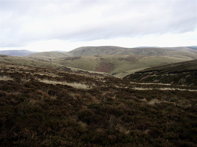
Beef Stand looking to Black Braes and Windy Gyle
An area of isolated rough grazing south of Beef Stand Hill. The name suggests cattle were kept here in days gone by. A remote area of a similar nature in the Moffat Hills is also called Beef Stand and was used as hiding place for stolen cattle in the historical days of the Reivers (Cattle Raiders) on the English-Scottish Border.
 Map © Crown Copyright")
TIP: Click the map for more Large scale mapping
- Grid Square
- NT8213, 2 images (more nearby 🔍)
- Photographer
- Kenneth Ross (more nearby)
- Date Taken
- Tuesday, 13 November, 2007 (more nearby)
- Submitted
- Saturday, 17 November, 2007
- Subject Location
-
OSGB36:
 NT 826 139 [100m precision]
WGS84: 55:25.1222N 2:16.5190W - Camera Location
-
OSGB36: NT 825 139
- View Direction
- EAST (about 90 degrees)