2019
TL9650 : St Mary, Kettlebaston - north elevation
taken 5 years ago, near to Kettlebaston, Suffolk, England
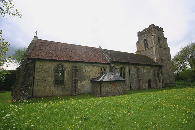
St Mary, Kettlebaston - north elevation
The north faces of churches don't seem very popular with Geographers, probably because they are usually less photogenic than their opposite counterparts and lighting conditions are often problematic given our geographical position.
 Map © Crown Copyright")
TIP: Click the map for more Large scale mapping
- Grid Square
- TL9650, 49 images (more nearby 🔍)
- Photographer
- David Kemp (more nearby)
- Date Taken
- Saturday, 11 May, 2019 (more nearby)
- Submitted
- Sunday, 12 May, 2019
- Subject Location
-
OSGB36:
 TL 9657 5028 [10m precision]
WGS84: 52:6.9532N 0:52.1733E - Camera Location
-
OSGB36: TL 9657 5029
- View Direction
- SOUTH (about 180 degrees)