2019

NY7637 : Tynehead

taken 5 years ago, 4 km SSE of Garrigill, Cumbria, England
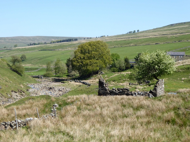
Tynehead
Tynehead
Ruined mine buildings in the foreground. Tynehead Farm beyond.

Creative Commons Licence [Some Rights Reserved]   © Copyright Oliver Dixon and licensed for reuse under this Creative Commons Licence.
Geographical Context: Uplands Farm, Fishery, Market Gardening Rivers, Streams, Drainage Quarrying, Mining Woodland, Forest Primary Subject: Valley other tags: Valley Trees River Farm Ruined Mine Building Click a tag, to view other nearby images.
This photo is linked from: Automatic Clusters: · Ruin [4] ·
1:50,000 Modern Day Landranger(TM) Map © Crown Copyright
+
+
1:50,000 Modern Day Landranger(TM) Map © Crown Copyright
TIP: Click the map for more Large scale mapping
Grid Square
NY7637, 39 images   (more nearby 🔍)
Photographer
Oliver Dixon   (more nearby)
Date Taken
Thursday, 16 May, 2019   (more nearby)
Submitted
Saturday, 18 May, 2019
Subject Location
OSGB36: geotagged! NY 7614 3781 [10m precision]
WGS84: 54:44.0817N 2:22.3240W
Camera Location
OSGB36: geotagged! NY 76122 37746
View Direction
North-northeast (about 22 degrees)
Clickable map
+
NW N NE
W Go E
SW S SE
Image Type (about): geograph 
This page has been viewed about 18 times
You are not logged in login | register