2019
SD9902 : Scorched Earth, Saddleworth Moor
taken 5 years ago, near to Buckton Vale, Tameside, England
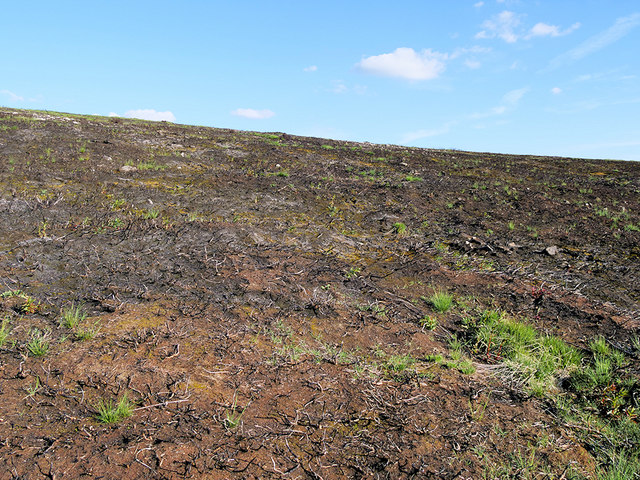
Scorched Earth, Saddleworth Moor
Most of the vegetation here was destroyed during a moorland fire in February, leaving a desolate-looking landscape.
 Map © Crown Copyright")
TIP: Click the map for more Large scale mapping
- Grid Square
- SD9902, 14 images (more nearby 🔍)
- Photographer
- David Dixon (more nearby)
- Date Taken
- Thursday, 16 May, 2019 (more nearby)
- Submitted
- Tuesday, 21 May, 2019
- Subject Location
-
OSGB36:
 SD 995 026 [100m precision]
WGS84: 53:31.2043N 2:0.5407W - Camera Location
-
OSGB36: SD 995 029
- View Direction
- SOUTH (about 180 degrees)