2019
NT8414 : Unnamed cleugh, valley of the Rowhope Burn
taken 5 years ago, 4 km NNE of Blindburn, Northumberland, England
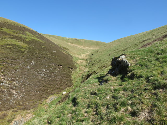
Unnamed cleugh, valley of the Rowhope Burn
This small cleugh begins its life 250 metres south of the Anglo/Scottish border (and the Pennine Way footpath) and joins the Rowhope Burn close to where this photograph was taken. For a selection of detailed free to download walking routes in the area visit Link
 Map © Crown Copyright")
TIP: Click the map for more Large scale mapping
- Grid Square
- NT8414, 20 images (more nearby 🔍)
- Photographer
- Geoff Holland (more nearby)
- Date Taken
- Thursday, 16 May, 2019 (more nearby)
- Submitted
- Tuesday, 21 May, 2019
- Subject Location
-
OSGB36:
 NT 8424 1489 [10m precision]
WGS84: 55:25.6591N 2:15.0343W - Camera Location
-
OSGB36: NT 8424 1482
- View Direction
- NORTH (about 0 degrees)