2019
SY4592 : Eype: Cockcrowing junction
taken 5 years ago, near to Eype, Dorset, England
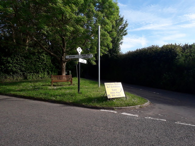
Eype: Cockcrowing junction
This is the road that links Eype, ahead, with everywhere else. The signpost is topped with a traditional Dorset roundel giving location 'COCKCROWING' and six-figure grid reference, but I have passed this way many times over the years and I am sure this is a fairly recent replica.
See SY4592 : Eype: detail of Cockcrowing signpost for a close-up of the roundel.
See SY4592 : Eype: detail of Cockcrowing signpost for a close-up of the roundel.
 Map © Crown Copyright")
TIP: Click the map for more Large scale mapping
- Grid Square
- SY4592, 64 images (more nearby 🔍)
- Photographer
- Chris Downer (more nearby)
- Date Taken
- Saturday, 1 June, 2019 (more nearby)
- Submitted
- Saturday, 1 June, 2019
- Subject Location
-
OSGB36:
 SY 4513 9212 [10m precision]
WGS84: 50:43.5658N 2:46.7245W - Camera Location
-
OSGB36: SY 4513 9214
- View Direction
- SOUTH (about 180 degrees)