2017
NO7356 : Scurdie Rock
taken 7 years ago, near to Ferryden, Angus, Scotland
This is 1 of 2 images, with title Scurdie Rock in this square
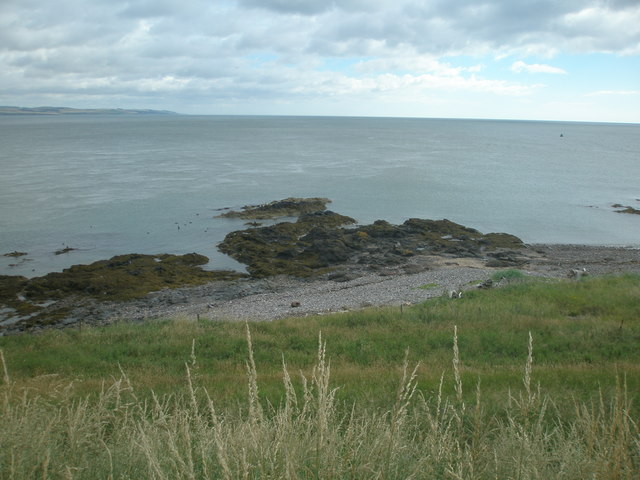
Scurdie Rock
Scurdie Rock, is shown projecting into the estuary of the River South Esk. It lies to the immediate west of Johnny Main's Harbour. The feature is clearly shown on the 1:10,560 (Six Inch) Ordnance Survey map surveyed in 1861 and published in 1865.
 Map © Crown Copyright")
TIP: Click the map for more Large scale mapping
- Grid Square
- NO7356, 129 images (more nearby 🔍)
- Photographer
- Adrian Diack (more nearby)
- Date Taken
- Saturday, 29 July, 2017 (more nearby)
- Submitted
- Tuesday, 4 June, 2019
- Subject Location
-
OSGB36:
 NO 7315 5682 [10m precision]
WGS84: 56:42.1388N 2:26.4058W - Camera Location
-
OSGB36: NO 7311 5675
- View Direction
- North-northeast (about 22 degrees)