2017
NO7356 : Scurdie Rock viewed from Johnny Main's Harbour
taken 7 years ago, near to Ferryden, Angus, Scotland
This is 1 of 3 images, with title starting with Scurdie in this square
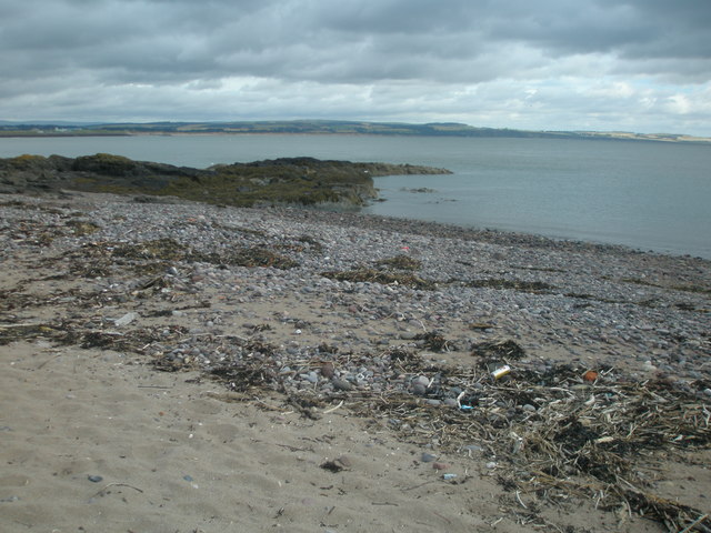
Scurdie Rock viewed from Johnny Main's Harbour
Johnny Main's Harbour was used for beaching small boats while Scurdie Rock provided some shelter but also acted as a navigation hazard.
 Map © Crown Copyright")
TIP: Click the map for more Large scale mapping
- Grid Square
- NO7356, 129 images (more nearby 🔍)
- Photographer
- Adrian Diack (more nearby)
- Date Taken
- Saturday, 29 July, 2017 (more nearby)
- Submitted
- Tuesday, 4 June, 2019
- Subject Location
-
OSGB36:
 NO 7314 5683 [10m precision]
WGS84: 56:42.1441N 2:26.4157W - Camera Location
-
OSGB36: NO 7315 5680
- View Direction
- North-northwest (about 337 degrees)