J1119 : The Ferry Hill near Omeath
taken 16 years ago, 3 km from Warrenpoint, Co Down, Northern Ireland
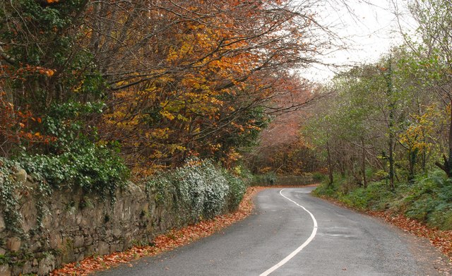
The Ferry Hill near Omeath
The Ferry Hill is part of the back road from Omeath to Newry. The view is to Omeath just inside Co Louth.
![Creative Commons Licence [Some Rights Reserved]](https://s1.geograph.org.uk/img/somerights20.gif)
|
· Find out How to reuse this image ·
Share:
|
|||||
|
There are 5 posts in a
discussion on J1119 (preview on the left) |
Suggest an update to this image | Contact the contributor | |||
Loading map... (JavaScript required)
- Grid Square
- J1119, 53 images (more nearby
 )
)
- Photographer
- Albert Bridge (find more nearby)
- Date Taken
- Thursday, 22 November, 2007 (more nearby)
- Submitted
- Thursday, 22 November, 2007
- Category
- Road > Road (more nearby)
- Subject Location
-
Irish:
 J 114 190 [100m precision]
WGS84: 54:6.5006N 6:17.8226W - Camera Location
-
Irish: J 113 190
- View Direction
- East-southeast (about 112 degrees)
Image classification(about):
Geograph (Second Visitor for J1119)
This page has been viewed about 173 times.
View this location:
KML (Google Earth) ·
Google Maps ·
Bing Maps ·
Geograph Coverage Map ·
More Links for this image
·
Bing Maps ·
Geograph Coverage Map ·
More Links for this image