2019
NT1230 : Sunshine in Tweeddale
taken 5 years ago, near to Stanhope, Scottish Borders, Scotland
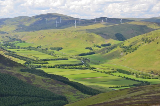
Sunshine in Tweeddale
Flat farming land is at a premium in the valley but what there is has been parcelled out in a sequence of fields. Across the valley are the 11 turbines of the Glenkerie wind farm, with others of the larger Clyde wind farm in the distance. The viewpoint is the saddle W of Drumelzier Law.
 Map © Crown Copyright")
TIP: Click the map for more Large scale mapping
- Grid Square
- NT1230, 35 images (more nearby 🔍)
- Photographer
- Jim Barton (more nearby)
- Date Taken
- Monday, 10 June, 2019 (more nearby)
- Submitted
- Wednesday, 12 June, 2019
- Subject Location
-
OSGB36:
 NT 1209 3021 [10m precision]
WGS84: 55:33.4573N 3:23.7138W - Camera Location
-
OSGB36: NT 1427 3145
- View Direction
- West-southwest (about 247 degrees)