2019
TQ4583 : Eastbury Manor House, Barking: north elevation
taken 5 years ago, near to Barking, Barking And Dagenham, England
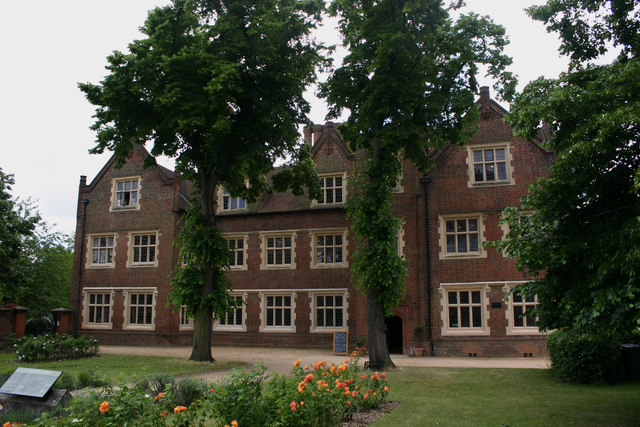
Eastbury Manor House, Barking: north elevation
Surprisingly the only previous occasion on which this historic building was Geographed was in 2005. It dates from the mid-C16 and was built for the merchant Clement Syssley. Over the centuries it fell into disrepair until being acquired by the National Trust in 1918. It is set somewhat incongruously in the midst of a large area of former local authority housing.
 Map © Crown Copyright")
TIP: Click the map for more Large scale mapping
- Grid Square
- TQ4583, 72 images (more nearby 🔍)
- Photographer
- David Kemp (more nearby)
- Date Taken
- Friday, 14 June, 2019 (more nearby)
- Submitted
- Saturday, 15 June, 2019
- Subject Location
-
OSGB36:
 TQ 4571 8381 [10m precision]
WGS84: 51:32.0638N 0:5.9649E - Camera Location
-
OSGB36: TQ 4570 8384
- View Direction
- South-southeast (about 157 degrees)