2007
SX5857 : Venton Sewage Works
taken 16 years ago, near to Sparkwell, Devon, England
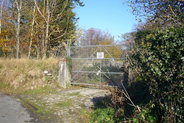
Venton Sewage Works
Venton Sewage Works is marked on the 1:25000 OS map, immediately North of the railway line by Venton Bridge. The road from Sparkwell to Venton runs left to right in front of the entrance.
 Map © Crown Copyright")
TIP: Click the map for more Large scale mapping
- Grid Square
- SX5857, 41 images (more nearby 🔍)
- Photographer
- Nigel Mole (more nearby)
- Date Taken
- Friday, 23 November, 2007 (more nearby)
- Submitted
- Saturday, 24 November, 2007
- Subject Location
-
OSGB36:
 SX 583 571 [100m precision]
WGS84: 50:23.7993N 3:59.7012W - Camera Location
-
OSGB36: SX 583 571
- View Direction
- East-northeast (about 67 degrees)