2019
TQ9324 : Derelict Barn near Iden Lock
taken 5 years ago, near to Iden, East Sussex, England
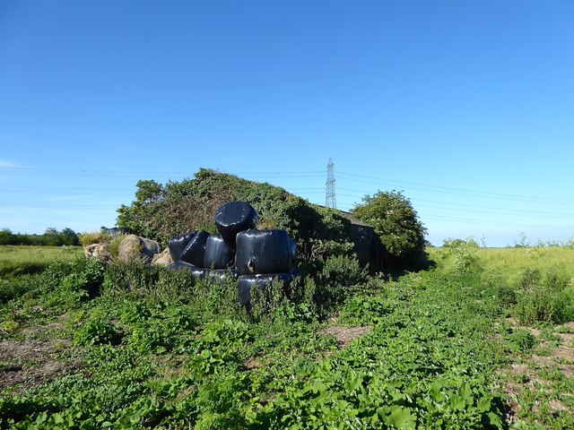
Derelict Barn near Iden Lock
Largely overgrown and seemingly disused near to Iden Lock. Old maps show a house and other farm buildings once existed during the interwar period but had disappeared after being replaced by this one. A footpath runs past the barn on the right hand side which was my intended route but was impassable due to the rape crop.
 Map © Crown Copyright")
TIP: Click the map for more Large scale mapping
- Grid Square
- TQ9324, 139 images (more nearby 🔍)
- Photographer
- Simon Carey (more nearby)
- Date Taken
- Saturday, 22 June, 2019 (more nearby)
- Submitted
- Tuesday, 25 June, 2019
- Subject Location
-
OSGB36:
 TQ 9373 2439 [10m precision]
WGS84: 50:59.1785N 0:45.5301E - Camera Location
-
OSGB36: TQ 9370 2437
- View Direction
- Northeast (about 45 degrees)