SU4704 : Ships and boats clustered around Fawley Marine Terminal
taken 5 years ago, near to Fawley, Hampshire, England
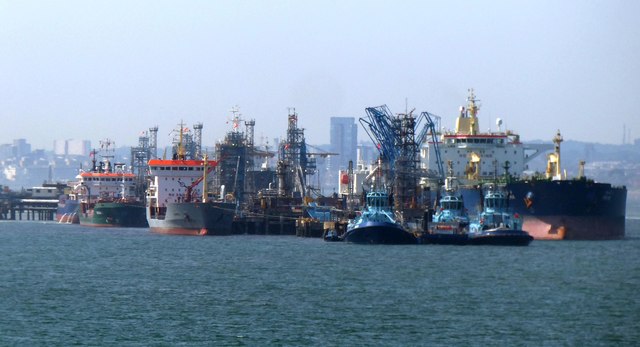
Photo taken from the roof of Calshot Castle.
Southampton Water is a tidal estuary north of the Solent and the Isle of Wight. Geographically, it is classified as a ria, or drowned valley, of the English Channel. It was formed by the rivers Test, Itchen and Hamble which flow into it, and became an inlet of the sea at the end of the last ice age when sea levels rose, flooding many valleys in the south of England.
The city of Southampton lies at the most northerly point of Southampton Water. Its emergence as a major port, and particularly as a port handling very large vessels, depended partly on certain geographical features of Southampton Water. Its depth, even in its undeveloped state, was generous; this depth of water has been increased over the years with comparative ease since the soft silt of the river-bed allows for easy dredging. An additional factor is the phenomenon of the "double tide", which results in unusually prolonged periods of high water. This greatly facilitates the movements of very large ships.
Together with the Solent, Southampton Water is world-renowned for yachting.
LinkWikipedia
 Map © Crown Copyright")
- Grid Square
- SU4704, 109 images (more nearby 🔍)
- Photographer
- Rob Farrow (more nearby)
- Date Taken
- Saturday, 29 June, 2019 (more nearby)
- Submitted
- Tuesday, 2 July, 2019
- Subject Location
-
OSGB36:
 SU 475 042 [100m precision]
WGS84: 50:50.1395N 1:19.6100W - Camera Location
-
OSGB36: SU 489 025
- View Direction
- Northwest (about 315 degrees)