1993
TL1987 : Peterborough (Conington) from the Air
taken 30 years ago, near to Holme, Cambridgeshire, England
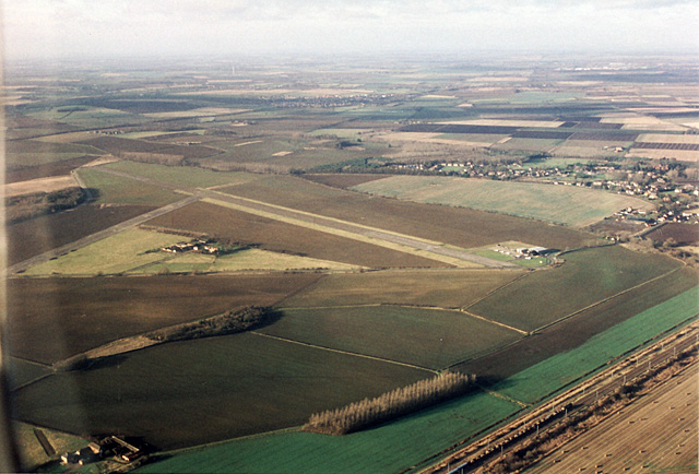
Peterborough (Conington) from the Air
One of two airfields serving Peterborough. The village to the north of the airfield is Holme. In the distant centre of the photo is Stilton. The dark line passing from upper left of the photo past Stilton is the A1M. In the right foreground, an engineers train trundles up the Kings Cross to Peterborough line.
 Map © Crown Copyright")
TIP: Click the map for more Large scale mapping
- Grid Square
- TL1987, 50 images (more nearby 🔍)
- Photographer
- Martin Addison (more nearby)
- Date Taken
- Sunday, 5 December, 1993 (more nearby)
- Submitted
- Monday, 26 November, 2007
- Subject Location
-
OSGB36:
 TL 190 870 [100m precision]
WGS84: 52:28.0783N 0:14.9536W - Camera Location
-
OSGB36: TL 204 855
- View Direction
- Northwest (about 315 degrees)