2019
SO0956 : Lane across open hill grazing land at Camnant
taken 5 years ago, near to Llansantffraed-in-Elwel, Powys, Wales
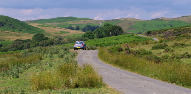
Lane across open hill grazing land at Camnant
The lane eventually joins the "Rhogo" road over the hill to Howey and Llandrindod Wells, which can be seen heading up to the skyline.
 Map © Crown Copyright")
TIP: Click the map for more Large scale mapping
- Grid Square
- SO0956, 9 images (more nearby 🔍)
- Photographer
- Andrew Hill (more nearby)
- Date Taken
- Tuesday, 16 July, 2019 (more nearby)
- Submitted
- Tuesday, 16 July, 2019
- Subject Location
-
OSGB36:
 SO 0974 5636 [10m precision]
WGS84: 52:11.8834N 3:19.3211W - Camera Location
-
OSGB36: SO 0978 5635
- View Direction
- West-northwest (about 292 degrees)