2007
SX5656 : Ancient hedgebank in Chaddlewood
taken 16 years ago, near to Plympton, Plymouth, England
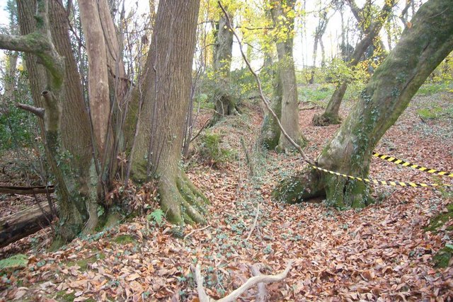
Ancient hedgebank in Chaddlewood
This is one of three hedgebanks that are shown on the 1:25000 OS map, which run North-South. They are presumably field boundaries that pre-date the planting of the wood. They are also mirrored on the other side of the railway suggesting that they were cut through when the line was built to Plymouth in 1849.
 Map © Crown Copyright")
TIP: Click the map for more Large scale mapping
- Grid Square
- SX5656, 47 images (more nearby 🔍)
- Photographer
- Nigel Mole (more nearby)
- Date Taken
- Sunday, 25 November, 2007 (more nearby)
- Submitted
- Tuesday, 27 November, 2007
- Subject Location
-
OSGB36:
 SX 563 567 [100m precision]
WGS84: 50:23.5544N 4:1.3792W - Camera Location
-
OSGB36: SX 563 567
- View Direction
- South-southeast (about 157 degrees)