TQ3380 : River Thames, HMS Belfast & Tower Bridge
taken 5 years ago, near to City of London, The City of London, England
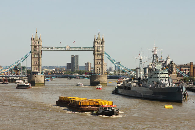
Tower Bridge is a combined bascule and suspension bridge over the River Thames. It is close to the Tower of London.
The bridge consists of two towers which are tied together at the upper level by means of two horizontal walkways which are designed to withstand the horizontal forces exerted by the suspended sections of the bridge on the landward sides of the towers.
More details from Wikipedia Link
HMS Belfast is an ex-Royal Navy Town-class cruiser and now a museum ship operated by the Imperial War Museum. Commissioned in August 1939 shortly before the outbreak of the Second World War, She was decommissioned in 1963 and now is located near to Tower Bridge and measures 613.5 ft (186.99 m) in length.
More details at Wikipedia Link
HMS Belfast website: Link
 Map © Crown Copyright")
- Grid Square
- TQ3380, 6748 images (more nearby 🔍)
- Photographer
- Richard Croft (more nearby)
- Date Taken
- Wednesday, 24 July, 2019 (more nearby)
- Submitted
- Friday, 26 July, 2019
- Subject Location
-
OSGB36:
 TQ 3331 8042 [10m precision]
WGS84: 51:30.4197N 0:4.8320W - Camera Location
-
OSGB36: TQ 3281 8054
- View Direction
- East-southeast (about 112 degrees)