2019
NY8590 : Boundary Stone
taken 5 years ago, 4 km SW of Otterburn, Northumberland, England
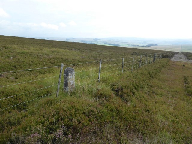
Boundary Stone
The 'C' might stand for Corsenside.
The fence / boundary is dead straight for more than 3 km.
The fence / boundary is dead straight for more than 3 km.
 Map © Crown Copyright")
TIP: Click the map for more Large scale mapping
- Grid Square
- NY8590, 4 images (more nearby 🔍)
- Photographer
- Russel Wills (more nearby)
- Date Taken
- Friday, 26 July, 2019 (more nearby)
- Submitted
- Saturday, 27 July, 2019
- Subject Location
-
OSGB36:
 NY 8579 9003 [10m precision]
WGS84: 55:12.2591N 2:13.4887W - Camera Location
-
OSGB36: NY 8579 9004
- View Direction
- Northeast (about 45 degrees)