2018
SX4553 : Looking across The Narrows
taken 6 years ago, near to Cremyll, Cornwall, England
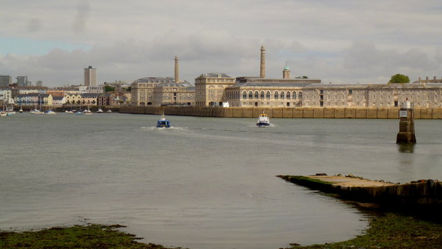
Looking across The Narrows
The Tamar estuary narrows between the Cremyll headland and the Royal William dockyard at Devil's Point.
The two Cremyll ferries can be seen passing each other in mid-stream.
The two Cremyll ferries can be seen passing each other in mid-stream.
 Map © Crown Copyright")
TIP: Click the map for more Large scale mapping
- Grid Square
- SX4553, 494 images (more nearby 🔍)
- Photographer
- Jonathan Billinger (more nearby)
- Date Taken
- Wednesday, 15 August, 2018 (more nearby)
- Submitted
- Friday, 16 August, 2019
- Subject Location
-
OSGB36:
 SX 4594 5355 [10m precision]
WGS84: 50:21.6984N 4:10.0403W - Camera Location
-
OSGB36: SX 4541 5345
- View Direction
- EAST (about 90 degrees)