TQ7670 : Chatham Maritime - Pump House No 5
taken 5 years ago, near to Upper Upnor, Medway, England
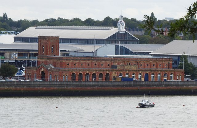
The pump house is EH Grade II listed Link
See a lot more information about it here: Link
The Chatham Dockyard's history dates back to 16th century and earlier. For centuries it was at the forefront of shipbuilding, and industrial and architectural technology and for 414 years, it provided over 500 ships to the Royal Navy. At its height the site covered over 400 acres.
The dockyard closed in 1984, and the now a 84 acre section of the site is a visitor attraction managed by the Chatham Historic Dockyard
Trust.
Wikipedia Link
The River Medway is 70 miles long and flows almost entirely within Kent. It rises in Ashdown Forest and joins the Thames near Chatham. Apart from the Thames it has the largest catchment area in southern England. The river is navigable as far as Tonbridge by large craft and as far as Penshurst by small craft. There are 11 locks on the river, between Allington and Tonbridge. The river is tidal to Allington Lock. The River divides Kent in two, those born west of the river are known as Kentish Men, whilst those born east of the river are Men of Kent. The river was used as a line of defence against possible invasion during WWII.
 Map © Crown Copyright")
- Grid Square
- TQ7670, 261 images (more nearby 🔍)
- Photographer
- Rob Farrow (more nearby)
- Date Taken
- Saturday, 17 August, 2019 (more nearby)
- Submitted
- Monday, 19 August, 2019
- Subject Location
-
OSGB36:
 TQ 7619 7016 [10m precision]
WGS84: 51:24.1861N 0:31.8988E - Camera Location
-
OSGB36: TQ 7585 7057
- View Direction
- Southeast (about 135 degrees)