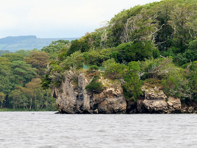
V9488 : Ross Island, Governor's Rock
taken 5 years ago, 4 km SSW of Killarney, Co Kerry, Ireland

Situated within the Killarney National Park, Lough Leane is largest and northernmost of the three lakes of Killarney Link
. Covering an area of approximately 4700 acres, it is also the largest freshwater lake in the region. The lake is in a low valley, 66 feet above sea level; the River Laune drains Lough Leane to the north-west towards Killorglin and into Dingle Bay.
Killarney National Park (Irish: Páirc Náisiúnta Chill Airne), near the town of Killarney, County Kerry, was the first national park in Ireland, created when Muckross Estate was donated to the Irish Free State in 1932.
The park has since been substantially expanded and now encompasses more than 25000 acres of diverse ecology, including the Lakes of Killarney, oak and yew woodlands of international importance, and mountain peaks. It has the only red deer herd on mainland Ireland and the most extensive covering of native forest remaining in Ireland.
- Grid Square
- V9488, 41 images (more nearby
 )
)
- Photographer
- David Dixon (find more nearby)
- Date Taken
- Tuesday, 13 August, 2019 (more nearby)
- Submitted
- Monday, 19 August, 2019
- Geographical Context
- Camera (from Tags)
- Lough (from Tags)
- Subject Location
-
Irish:
 V 940 883 [100m precision]
WGS84: 52:2.2735N 9:32.6574W - Camera Location
-
Irish:
 V 938 878
 - View Direction
- North-northeast (about 22 degrees)
![Creative Commons Licence [Some Rights Reserved]](https://s1.geograph.org.uk/img/somerights20.gif)
