TR0161 : The Training Ship "Hasarde"
taken 5 years ago, near to Faversham, Kent, England
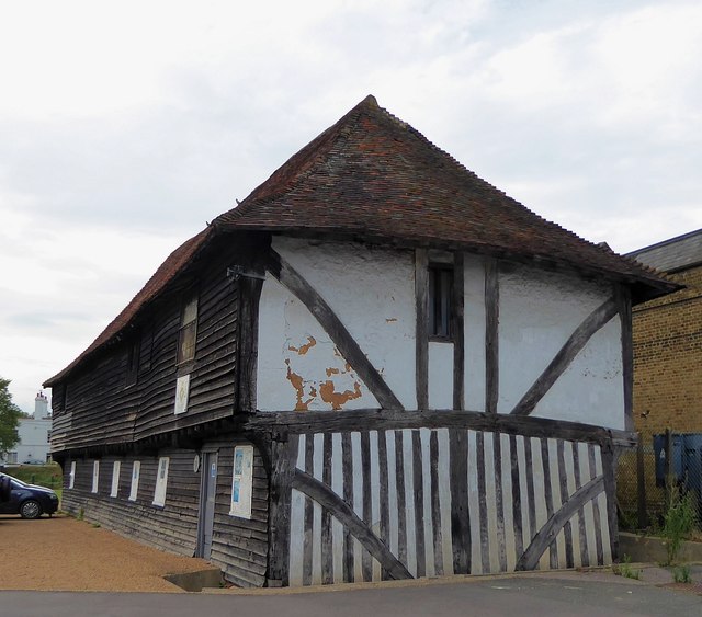
It is now used as a training ship by the Sea Cadets. Behind it lies Faversham Creek.
It is EH Grade II* listed: Link
Faversham Creek is a tidal creek running north to The Swale at Harty Ferry.
The navigable creek flows into The Swale, the Thames estuary and then to the North Sea.
The creek rises in Davington and flows through Faversham before meandering through the North Kent Marshes with its abundance of wildlife and into The Swale, making it an ideal place for walking, boating and bird watching.
Faversham Creek is the key to the existence to the town of Faversham.
Without the Creek, Faversham would never have existed. Its value for the discharge and loading of cargoes was recognised in prehistoric times, when a settlement was established not far from Standard Quay; a Roman villa (luxury farmstead) came next; and then 1,000 years later, in 1147, work began on building a huge Abbey nearby. Stone for this was imported from France through the Creek.
 Map © Crown Copyright")
- Grid Square
- TR0161, 1908 images (more nearby 🔍)
- Photographer
- Rob Farrow (more nearby)
- Date Taken
- Saturday, 17 August, 2019 (more nearby)
- Submitted
- Thursday, 22 August, 2019
- Subject Location
-
OSGB36:
 TR 0158 6161 [10m precision]
WGS84: 51:19.0725N 0:53.4816E - Camera Location
-
OSGB36: TR 0159 6159
- View Direction
- North-northwest (about 337 degrees)