2005
SZ4888 : Ford at Carisbrooke
taken 19 years ago, near to Carisbrooke, Isle of Wight, England
This is 1 of 2 images, with title Ford at Carisbrooke in this square
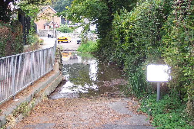
Ford at Carisbrooke
The Lukely Brook flows right through the middle of Carisbrooke and there are several fords on minor lanes crossing the bottom of the valley. This is the easternmost one, now closed to traffic, at Spring Lane.
 Map © Crown Copyright")
TIP: Click the map for more Large scale mapping
- Grid Square
- SZ4888, 150 images (more nearby 🔍)
- Photographer
- Ron Strutt (more nearby)
- Date Taken
- Wednesday, 5 October, 2005 (more nearby)
- Submitted
- Saturday, 8 October, 2005
- Subject Location
-
OSGB36:
 SZ 488 881 [100m precision]
WGS84: 50:41.4307N 1:18.6305W - Camera Location
-
OSGB36: SZ 4882 8818