W6154 : A map of the Battle
taken 5 years ago, near to Dunderrow, Co Cork, Ireland
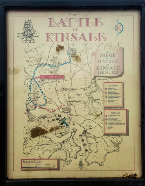
A map of the Battle
A notice board at the Ballyregan crossroads W6154 : The battle of Kinsale map outlines what happened at the Battle of Kinsale.
![Creative Commons Licence [Some Rights Reserved]](https://s1.geograph.org.uk/img/somerights20.gif)
|
· Find out How to reuse this image ·
Share:
|
|||||
| Start a discussion on W6154 | Suggest an update to this image | Contact the contributor | |||
Loading map... (JavaScript required)
- Grid Square
- W6154, 2 images (more nearby
 )
)
- Photographer
- Neville Goodman (find more nearby)
- Date Taken
- Tuesday, 3 September, 2019 (more nearby)
- Submitted
- Thursday, 5 September, 2019
- Geographical Context
- Primary Subject of Photo
- Subject Location
-
Irish:
 W 611 541 [100m precision]
WGS84: 51:44.3177N 8:33.8185W - Camera Location
-
Irish: W 611 541
- View Direction
- Northwest (about 315 degrees)
Image Type (about):
close look
This page has been viewed about 64 times.
View this location:
KML (Google Earth) ·
Google Maps ·
Bing Maps ·
Geograph Coverage Map ·
More Links for this image
·
Bing Maps ·
Geograph Coverage Map ·
More Links for this image