2019
NT1930 : Aircraft movements over the Manor Valley
taken 5 years ago, near to Font Stone [other Features], Scottish Borders, Great Britain
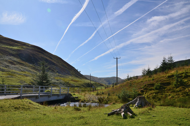
Aircraft movements over the Manor Valley
Condensation trails aligned roughly NW-SE seen from the bridge over the Kirkhope Burn.
 Map © Crown Copyright")
TIP: Click the map for more Large scale mapping
- Grid Square
- NT1930, 36 images (more nearby 🔍)
- Photographer
- Jim Barton (more nearby)
- Date Taken
- Sunday, 8 September, 2019 (more nearby)
- Submitted
- Monday, 9 September, 2019
- Subject Location
-
OSGB36:
 NT 1985 3071 [10m precision]
WGS84: 55:33.8071N 3:16.3433W - Camera Location
-
OSGB36: NT 1985 3073
- View Direction
- South-southeast (about 157 degrees)