2019
SO0984 : Mils Stone - Newtown 7
taken 5 years ago, 3 km from Pentre, Powys, Wales
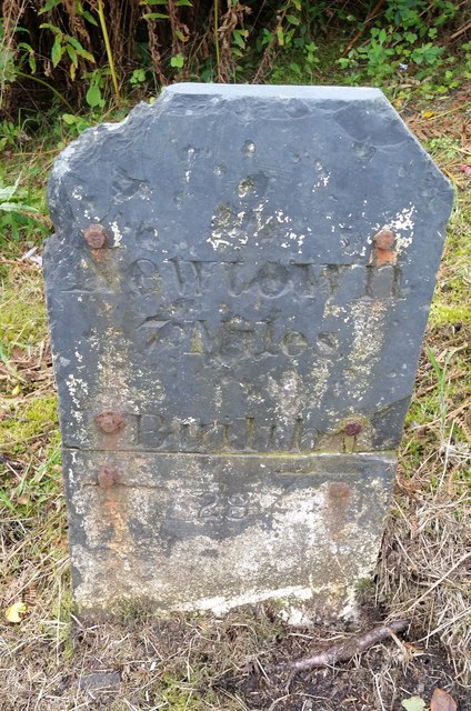
Mils Stone - Newtown 7
There is an Ordnance Survey Cut Mark on the stone which marked a point 1157.7ft above mean sea level. However the stone has been repositioned to the opposite side of the road and a little to the east.
 Map © Crown Copyright")
TIP: Click the map for more Large scale mapping
- Grid Square
- SO0984, 12 images (more nearby 🔍)
- Photographer
- Adrian Dust (more nearby)
- Date Taken
- Sunday, 15 September, 2019 (more nearby)
- Submitted
- Wednesday, 18 September, 2019
- Subject Location
-
OSGB36:
 SO 0900 8457 [10m precision]
WGS84: 52:27.0888N 3:20.4292W - Camera Location
-
OSGB36: SO 0900 8457
- View Direction
- Southeast (about 135 degrees)