2019
NN8323 : Castle Cluggy
taken 5 years ago, near to Ochtertyre, Perth And Kinross, Scotland
This is 1 of 3 images, with title Castle Cluggy in this square
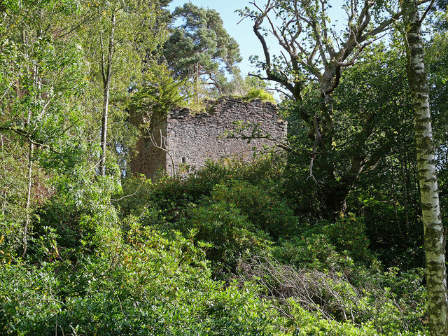
Castle Cluggy
The ruined remains of a former tower house located on a steep mound on the Dry Isle, a promontory jutting into Loch Monzievaird. The castle dates back to (at least) the 14th century when a rectangular hall was built on the site. Today the remains are about 7m square, the eastern section having been demolished. By the mid 1600's the castle belonged to the Murrays of Ochtertyre.
 Map © Crown Copyright")
TIP: Click the map for more Large scale mapping
- Grid Square
- NN8323, 10 images (more nearby 🔍)
- Photographer
- Dr Richard Murray (more nearby)
- Date Taken
- Friday, 13 September, 2019 (more nearby)
- Submitted
- Sunday, 22 September, 2019
- Subject Location
-
OSGB36:
 NN 8397 2340 [10m precision]
WGS84: 56:23.3149N 3:52.8592W - Camera Location
-
OSGB36: NN 8392 2341
- View Direction
- East-southeast (about 112 degrees)