SK7154 : Southwell Workhouse
taken 5 years ago, near to Normanton, Nottinghamshire, England
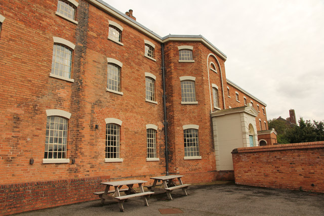
Built in 1824 as a union workhouse for the villages around Southwell, it was originally known as the Thurgarton Incorporation Workhouse. Southwell had its own smaller workhouse at that time (now the Baptist Chapel), but joined in 1834, when it became the Southwell Union Workhouse.
The design was based on the ideas of the Rv. J.T.Becher, a local man, with segregation of the various classes of inmate, and it became the model for the hundreds of workhouses erected as a result of the 1834 Poor Law Amendment Act.
In the latter part of the 19th century, many workhouses developed into Hospitals. At Southwell a new infirmary wing was built in 1871 to house the sick and infirm, with the original building continuing to provide residential accommodation for the poor. This function continued in modified form right up until the 1980s, and as a result the interior remained remarkably little altered. As such it provides a remarkable example of an early 19th century workhouse. It is currently run by the National Trust.
The main building is Listed Grade II*, and the range of outbuildings on the northern side is Listed Grade II. The gardens to the front of the building have been partly restored to their original use as a vegetable gardenand are also Listed Grade II*.
More details:
English Heritage listing Link
National Trust HBSMR (from EH site) Link
The Workhouse website (History) Link
 Map © Crown Copyright")
- Grid Square
- SK7154, 86 images (more nearby 🔍)
- Photographer
- Richard Croft (more nearby)
- Date Taken
- Monday, 30 September, 2019 (more nearby)
- Submitted
- Sunday, 6 October, 2019
- Subject Location
-
OSGB36:
 SK 7114 5427 [10m precision]
WGS84: 53:4.8555N 0:56.3661W - Camera Location
-
OSGB36: SK 7113 5427
- View Direction
- EAST (about 90 degrees)