2007
NS5056 : The Craigie
taken 16 years ago, near to Netherplace, East Renfrewshire, Scotland
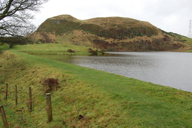
The Craigie
The Craig of Carnock or 'The Craigie' as it's known locally (Duncarnock on the OS map), is a volcanic plug overlooking Glanderston dam and the site of an ancient hill fort.
 Map © Crown Copyright")
TIP: Click the map for more Large scale mapping
- Grid Square
- NS5056, 33 images (more nearby 🔍)
- Photographer
- G McK (more nearby)
- Date Taken
- Saturday, 8 December, 2007 (more nearby)
- Submitted
- Saturday, 8 December, 2007
- Subject Location
-
OSGB36:
 NS 501 560 [100m precision]
WGS84: 55:46.4417N 4:23.4787W - Camera Location
-
OSGB36: NS 500 562
- View Direction
- South-southeast (about 157 degrees)