2019
NS2052 : Isle of Arran from Hunterston, North Ayrshire
taken 5 years ago, 3 km from Fairlie, North Ayrshire, Scotland
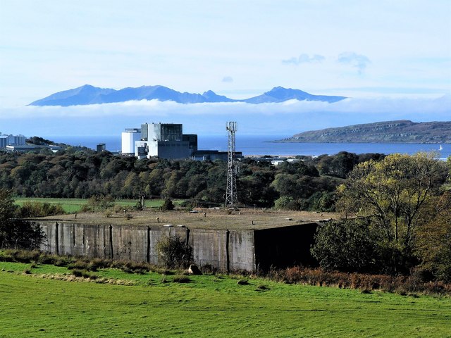
Isle of Arran from Hunterston, North Ayrshire
Looking towards the isles of Arran and Wee Cumbrae from the covered reservoir which served Hunterston Ore Terminal.
 Map © Crown Copyright")
TIP: Click the map for more Large scale mapping
- Grid Square
- NS2052, 71 images (more nearby 🔍)
- Photographer
- Raibeart MacAoidh (more nearby)
- Date Taken
- Tuesday, 15 October, 2019 (more nearby)
- Submitted
- Friday, 18 October, 2019
- Subject Location
-
OSGB36:
 NS 2038 5224 [10m precision]
WGS84: 55:43.8098N 4:51.7219W - Camera Location
-
OSGB36: NS 2055 5231
- View Direction
- West-southwest (about 247 degrees)