2019
SD5329 : Fishergate Bridge, Preston
taken 4 years ago, near to Higher Penwortham, Lancashire, England
This is 1 of 4 images, with title starting with Fishergate Bridge in this square
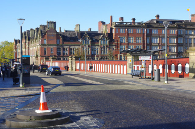
Fishergate Bridge, Preston
Fishergate Bridge crosses the northern end of Preston station; beyond that is Lancashire County Hall. Leading off to the left, marked by the traffic cone, is Butler Street.
 Map © Crown Copyright")
TIP: Click the map for more Large scale mapping
- Grid Square
- SD5329, 632 images (more nearby 🔍)
- Photographer
- Stephen McKay (more nearby)
- Date Taken
- Tuesday, 29 October, 2019 (more nearby)
- Submitted
- Wednesday, 30 October, 2019
- Subject Location
-
OSGB36:
 SD 5345 2921 [10m precision]
WGS84: 53:45.4295N 2:42.4507W - Camera Location
-
OSGB36: SD 5351 2921
- View Direction
- WEST (about 270 degrees)