2019
TQ7112 : Six Acres/Two Acres
taken 4 years ago, near to Ninfield, East Sussex, England
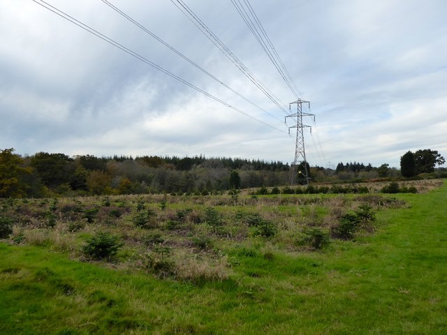
Six Acres/Two Acres
The name of the fields according to Catsfield's 1839 tithe map that have been merged along with TQ7112 : Barren Field to the east of the public footpath to form a larger unit. Six Acres was in the foreground whilst Two acres was to the north. Now belonging to Catsfield Christmas Tree Farm. Hurst Wood is to the left.
 Map © Crown Copyright")
TIP: Click the map for more Large scale mapping
- Grid Square
- TQ7112, 33 images (more nearby 🔍)
- Photographer
- Simon Carey (more nearby)
- Date Taken
- Monday, 28 October, 2019 (more nearby)
- Submitted
- Friday, 1 November, 2019
- Subject Location
-
OSGB36:
 TQ 7185 1244 [10m precision]
WGS84: 50:53.1534N 0:26.5072E - Camera Location
-
OSGB36: TQ 7193 1241
- View Direction
- West-northwest (about 292 degrees)