2019
NG5915 : The path to Suisnish
taken 4 years ago, 3 km from Ord/Ant t-Òrd, Isle of Skye, Scotland
This is 1 of 2 images, with title starting with The path to in this square
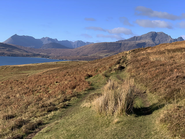
The path to Suisnish
Part of the old crofters' track between Borreraig and Suisnish that follows the north shore of Loch Eishort.
 Map © Crown Copyright")
TIP: Click the map for more Large scale mapping
- Grid Square
- NG5915, 38 images (more nearby 🔍)
- Photographer
- John Allan (more nearby)
- Date Taken
- Tuesday, 5 November, 2019 (more nearby)
- Submitted
- Thursday, 7 November, 2019
- Subject Location
-
OSGB36:
 NG 595 157 [100m precision]
WGS84: 57:10.1345N 5:58.7816W - Camera Location
-
OSGB36: NG 595 156
- View Direction
- West-northwest (about 292 degrees)