2019
SY2592 : Colyford Flood Relief Channel
taken 5 years ago, near to Colyford, Devon, England
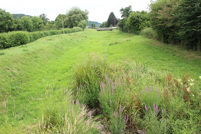
Colyford Flood Relief Channel
This channel which runs alongside the Seaton Tramway and Cowhayne lane carries flood water from the River Coly in times of flood. In the distance can be seen the bridge which takes the channel under the A3052.
 Map © Crown Copyright")
TIP: Click the map for more Large scale mapping
- Grid Square
- SY2592, 107 images (more nearby 🔍)
- Photographer
- Nigel Mykura (more nearby)
- Date Taken
- Saturday, 13 July, 2019 (more nearby)
- Submitted
- Wednesday, 20 November, 2019
- Subject Location
-
OSGB36:
 SY 2545 9277 [10m precision]
WGS84: 50:43.7847N 3:3.4588W - Camera Location
-
OSGB36: SY 2544 9287
- View Direction
- SOUTH (about 180 degrees)