2019
SE1836 : The Royal Oak, Stony Lane, Eccleshill
taken 4 years ago, 3 km from Calverley, Leeds, England
This is 1 of 2 images, with title starting with The Royal Oak, Stony Lane, Eccleshill in this square
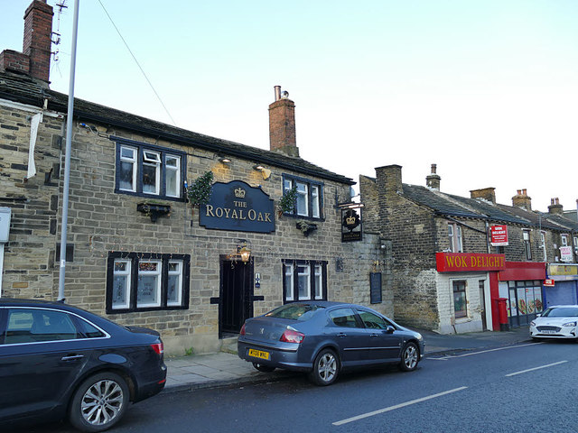
The Royal Oak, Stony Lane, Eccleshill
The pub was shown as "BH" (beer house) on the 1908 map. It is listed grade II (list entry 1291312) and was apparently converted from a pair of late 18th century cottages
 Map © Crown Copyright")
TIP: Click the map for more Large scale mapping
- Grid Square
- SE1836, 250 images (more nearby 🔍)
- Photographer
- Stephen Craven (more nearby)
- Date Taken
- Saturday, 30 November, 2019 (more nearby)
- Submitted
- Wednesday, 4 December, 2019
- Subject Location
-
OSGB36:
 SE 1820 3612 [10m precision]
WGS84: 53:49.2624N 1:43.5013W - Camera Location
-
OSGB36: SE 1820 3611
- View Direction
- North-northeast (about 22 degrees)