R4665 : Sixmilebridge railway station, County Clare
taken 4 years ago, near to Sixmilebridge, Co Clare, Ireland
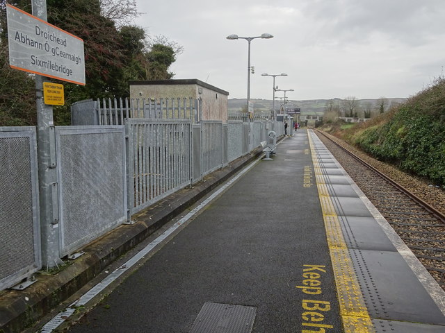
Sixmilebridge railway station, County Clare
Opened in 1859 by the Limerick and Ennis Railway, later part of the Great Southern & Western Railway, this station closed in 1963. It was rebuilt 150m to the north west and reopened in 2010 as part of the Western Corridor rail project.
View south east towards Cratloe and Limerick. The old station building can just be seen in the distance - see R4765 : Sixmilebridge railway station, County Clare for a view in the opposite direction.
View south east towards Cratloe and Limerick. The old station building can just be seen in the distance - see R4765 : Sixmilebridge railway station, County Clare for a view in the opposite direction.
![Creative Commons Licence [Some Rights Reserved]](https://s1.geograph.org.uk/img/somerights20.gif)
|
· Find out How to reuse this image ·
Share:
|
|||||
| Start a discussion on R4665 | Suggest an update to this image | Contact the contributor | |||
Loading map... (JavaScript required)
- Grid Square
- R4665 (more nearby
 )
)
- Photographer
- Nigel Thompson (find more nearby)
- Date Taken
- Friday, 13 December, 2019 (more nearby)
- Submitted
- Friday, 20 December, 2019
- Geographical Context
- Primary Subject of Photo
- Subject Location
-
Irish:
 R 469 654 [100m precision]
WGS84: 52:44.2849N 8:47.1417W - Camera Location
-
Irish: R 469 654
- View Direction
- East-southeast (about 112 degrees)
Other Tags
This page has been viewed about 88 times.
View this location:
KML (Google Earth) ·
Google Maps ·
Bing Maps ·
Geograph Coverage Map ·
More Links for this image
·
Bing Maps ·
Geograph Coverage Map ·
More Links for this image