2019
TQ2995 : Flood in London N14
taken 4 years ago, near to Southgate, Enfield, England
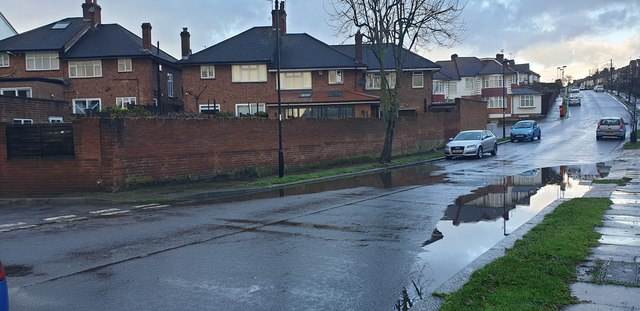
Flood in London N14
I think a drain blocked as this doesn't usually happen
 Map © Crown Copyright")
TIP: Click the map for more Large scale mapping
- Grid Square
- TQ2995, 1475 images (more nearby 🔍)
- Photographer
- Christine Matthews (more nearby)
- Date Taken
- Saturday, 21 December, 2019 (more nearby)
- Submitted
- Wednesday, 25 December, 2019
- Subject Location
-
OSGB36:
 TQ 2981 9590 [10m precision]
WGS84: 51:38.8152N 0:7.5132W - Camera Location
-
OSGB36: TQ 29825 95872
- View Direction
- North-northwest (about 337 degrees)